|
|
|
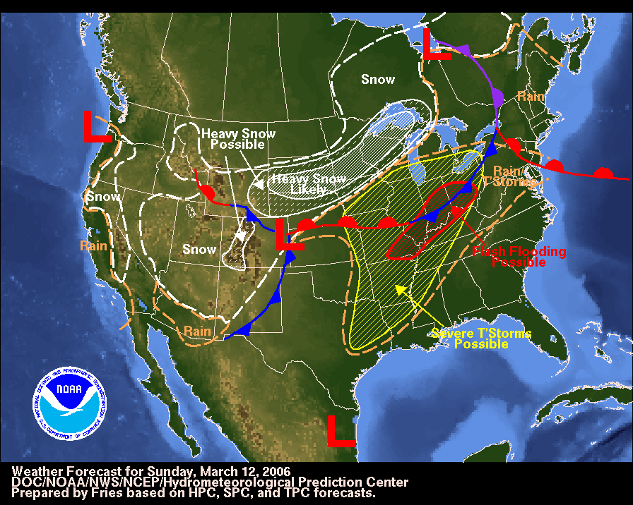
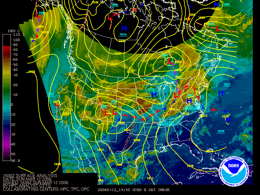
| This Forecast Surface Analysis for Sunday, March 12, 2006 shows the predicted areas of concern for the day's unfolding weather. Note the dry line and the Severe T'Storms Possible graphic around the Kansas City area. Image from the Hydrometeorological Prediction Center website. | This Surface Analysis for 15Z (9:00 am CST) March 12, 2006 shows the warm front still just south of the KC Metro area and the dry line in Oklahoma and Texas. The warm front surged back northward shortly after this and the dry line reached from the KC Metro area down through Oklahoma in time for the afternoon storms. The cold front, seen here in New Mexico, rapidly drove forward to pass through behind the squall line later in the evening (to end the evening's round of storms). Image from the Hydrometeorological Prediction Center website. |
 |
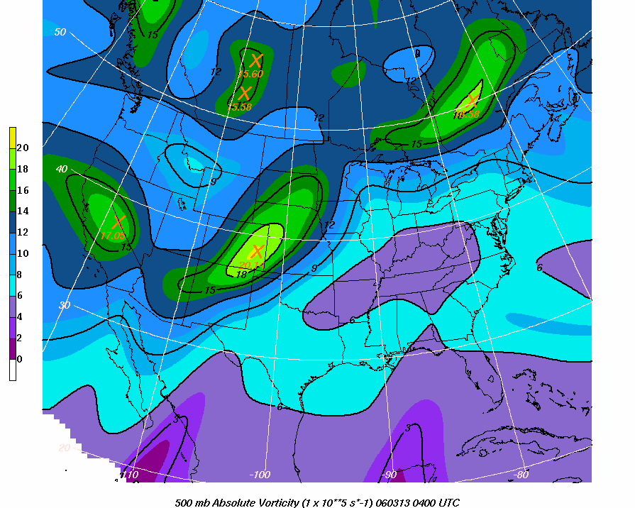 |
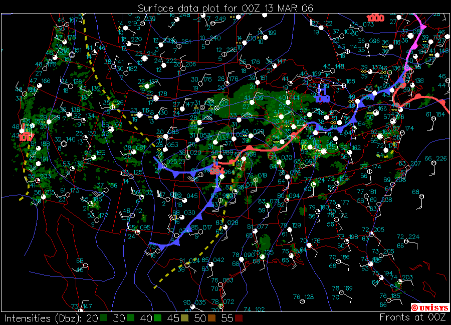
| The Surface Data Plot for 00Z (6:00 pm CST) March 13, 2006 showing the synoptic scale frontal and dry line positioning, Winds, Temperatures and Dew Points, and Precipitation. Image from the Unisys Weather Surface Image and Map Archive website. Note the frontal boundary through western Oklahoma and the Texas Panhandle-West Texas, and the dry line through central Kansas, Oklahoma, and Texas. | 500 mb Absolute Vorticity at 04Z (10:00 pm CST) March 13, 2006 from the Ohio State University website. This shows the synoptic setup with the potent vort max west of the Kansas City area, allowing for the low's strengthening to the east of the vort max due to strong upper-level divergence. The red X marks the spot. This image is valid for 3 hours after our 01Z cell, which was in the heart of the most severe third phase of the day's outbreak, and coincided with the squall line's formation. |
 |
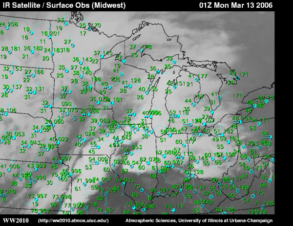 |
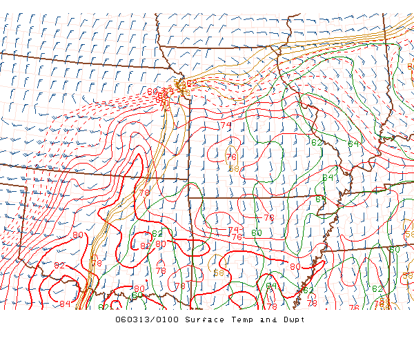
| Surface Temperature and Dew Point (also Winds) chart at 01Z March 13, 2006 from the SPC Mesoanalysis website. Note the southerly flow of air from the Gulf of Mexico and the high dew points. | IR Satellite and Surface Observations at 01Z March 13, 2006 from the University of Illinois WW2010 Surface Products website. Note the southerly flow of air from the Gulf of Mexico and high dew points, as well as the high, cold cloud tops lined up over Missouri. |
 |
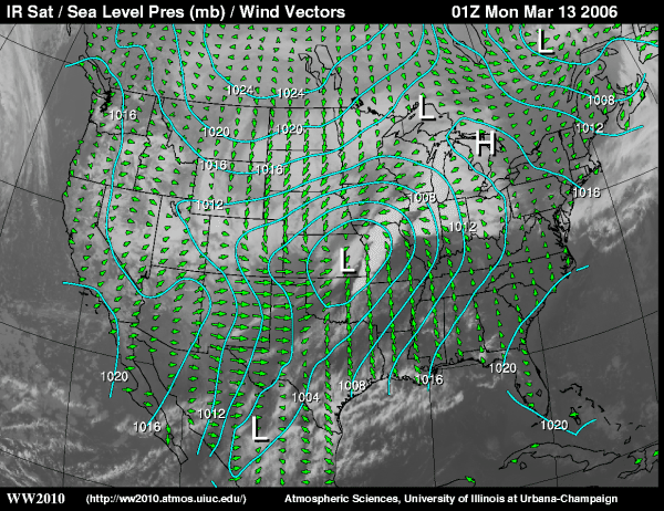 |
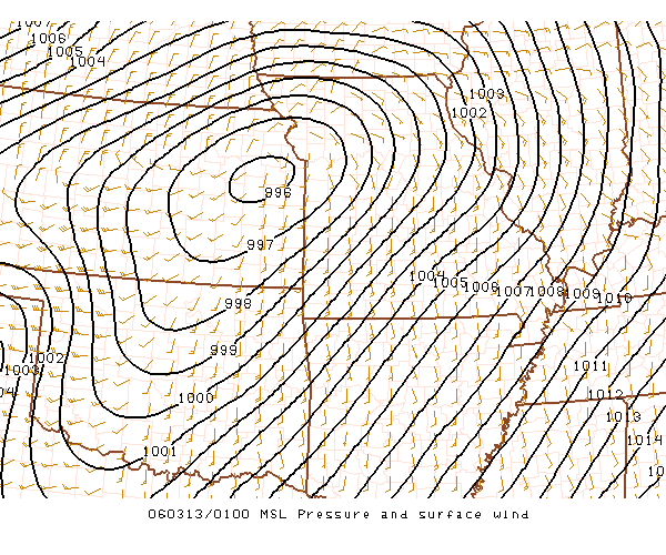
| Mean Sea Level Pressure and Surface wind chart at 01Z (7:00 pm CST) March 13, 2006 from the SPC Mesoanalysis website. Note the large pressure gradient over the most storm-stricken part of Missouri. | IR Satellite, Sea Level Pressure and Wind Vectors for 01Z (7:00 pm CST) March 13, 2006 from the University of Illinois WW2010 Surface Products website. Note the southerly flow of air from the Gulf of Mexico and the low practically on top of the KC Metro area, as well as the convergence of winds around the low. |
 |
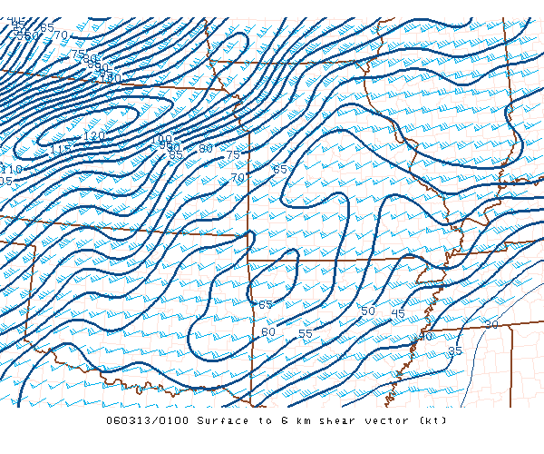 |
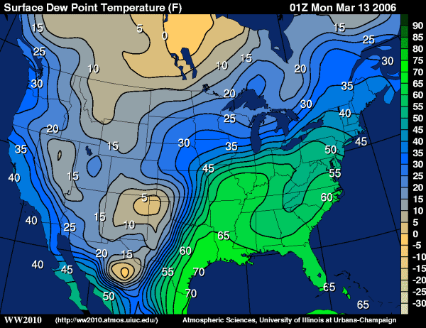
| Surface Dew Point Temperature at 01Z (7:00 pm CST) March 13, 2006 from the University of Illinois WW2010 Surface Products website. The 75-80 degree temp in the green area saw the worst storms and damage in the KC Metro area. | Surface to 6 km Wind Shear Vector at 01Z (7:00 pm CST) March 13, 2006 from the SPC Mesoanalysis website. Very favorable shear is indicated by the large values of 65-75 knots. |