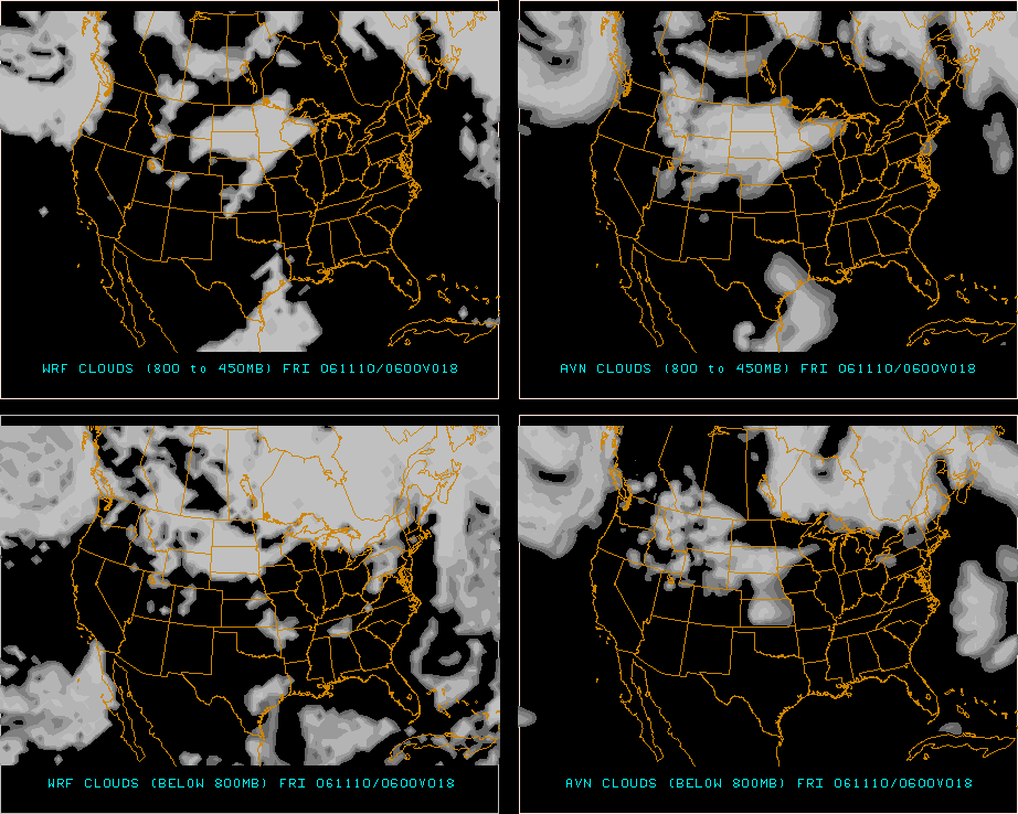
This progression of cloud progs from the PSU eWall show the clouds forecast to be moving into the Jackson area within the forecast period. The two top panels, left and right, are the WRF and AVN models for upper level clouds 800mb - 450 mb. The two bottom panels, left and right, are the WRF and AVN models for lower level clouds below 800 mb. Click on images for a larger view.
|
|
| This cloud prog shows clear upper level and clear lower level for both WRF and AVN models. 18 hour prog valid 06Z 11/10. |
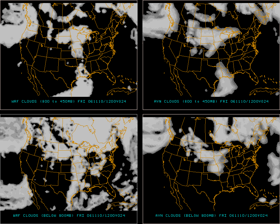 |
| This cloud prog shows clear upper level clouds to the southwest of KJAN for both WRF and AVN models, and lower level clouds moving in on the WRF model (clear lower level on the AVN model). 24 hour prog valid 12Z 11/10. |
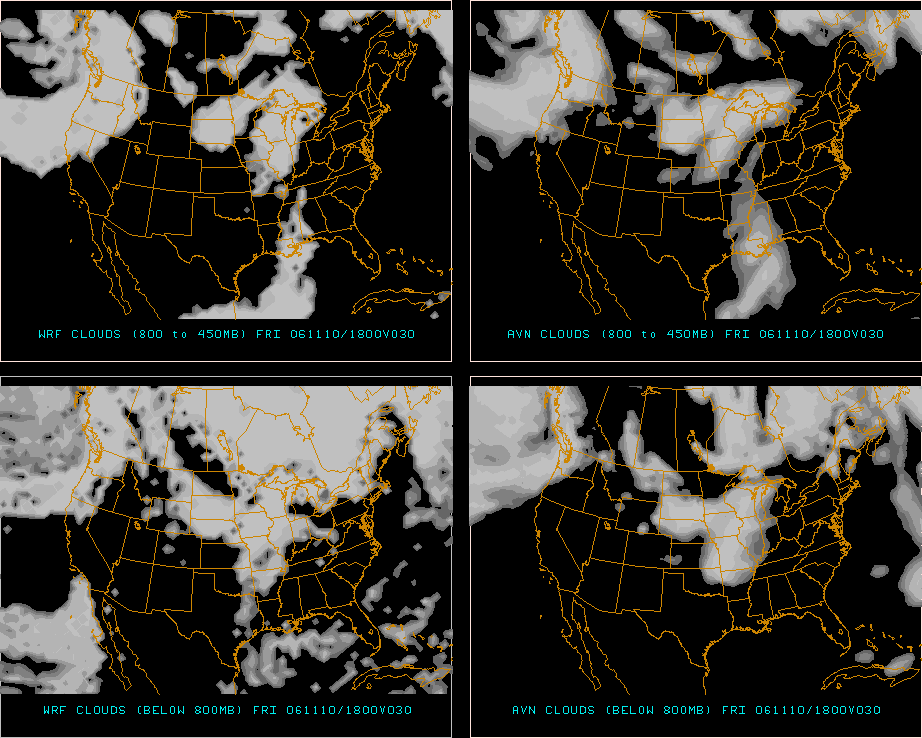 |
| This cloud prog shows upper level clouds on both WRF and AVN models, but clear lower level clouds on both models. 30 hour prog valid 18Z 11/10. |
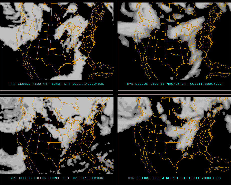 |
| This cloud prog shows clear upper level and clear lower level for both WRF and AVN models, with the upper level clouds having moved just east of KJAN. 36 hour prog valid 00Z 11/11. |
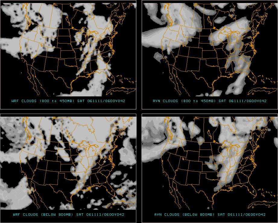 |
| This cloud prog shows upper level clouds moving back in from the northwest on both WRF and AVN models. The lower level clouds are just to the northwest on the WRF model, and already over KJAN on the AVN model. 42 hour prog valid 06Z 11/11. |