 |
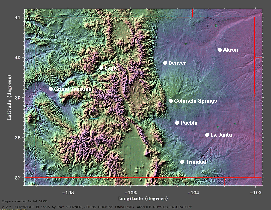
| Above is the landform map for the state of Colorado. Note Grand Junction in the high desert mountain valley to the left. Image from NOAA Earth System Research Laboratory. |
Climatology of
Grand Junction, Colorado KGJT
|
|
| Above is the landform map for the state of Colorado. Note Grand Junction in the high desert mountain valley to the left. Image from NOAA Earth System Research Laboratory. |
Grand Junction, Colorado sits in the high desert at 4,800 feet above sea level in Mesa County. Walker Field Airport (KGJT) is located three miles northeast of the city. Grand Junction is near the middle of the Grand Valley, which is known for its wineries, and is subject to valley breezes. It's the largest population center on the Colorado Western Slope (the western slope of the Rockies), and serves in an unofficial capacity as that region's capital city. It's historically home to the Ute tribe, was settled by white farmers in the 1880s, and is now a major fruit-growing region. Grand Junction lies along the north side of the Colorado River, with the Gunnison River connecting from the south. The city encompasses 31.1 miles, 30.8 miles of which is land and 0.3 miles of water. The total area is only 0.87% water, hence the name 'high desert.'
From the 1880s to the 1960s, the main economies were farming and cattle, then the vast oil reserves near Parachute in the Piceance Basin drew the interest of Exxon Mobile, who set up its seat of operations there. Oil shale was the commodity in demand, but when harvesting of the oil from the shale rock proved technologically difficult and thus not economically feasible, Exxon Mobile pulled out, leaving the region busted. This retreat by the oil company was known as "Black Sunday," May 2, 1982. This bust was felt statewide. Major oil companies have returned to the region to invest more conservatively due to the recent increase in oil prices and volatility in the Middle East.
Grand Junction's climate is semi-arid continental, overall. Spring and Fall are prolonged and enjoy much color, and are protected from frost by the valley breezes. Summers are warm and dry, with average highs in the 90s and average lows in the 60s. It was noted on the Wikipedia website that average temperatures have been increasing recently. You can locate local climate data here, here and here. Sudden and severe weather changes are infrequent, and summer rains occur mostly as scattered light showers and thunderstorms that develop over the mountains nearby. Relative humidity is low during summer, and sunny days are the norm for all seasons..
Winters are mostly mild, with frequent light snows that quickly melt. Heavy snows are rare, but also disappear quickly. Temperatures average between the 20s and 50s, but can go as low as -5°F. Precipitation is low in all seasons due to the protective topography of the surrounding mountains, which range from 9,000 ft to over 12,000 ft. Winds prevail from the east-southeast due to the valley breezes, and are generally light during cold weather. Cold waves are rare, but cold air sometimes becomes trapped in the valley, prolonging cold spells that do occur. April to September show the strongest winds, which occur during thunderstorms or with pre-frontal weather, and usually blow from the south or southwest at these times. The highest precipitation spike occurs in September, and is no more than 0.25 inches, as can be seen on the Local Climatological Data - Annual Summary with Comparative Data, a 2005 official report from U.S. Department of Commerce. This data comes from NOAA and NCDC records.
For our forecasting period of November 27 through December 9, the following means apply: daily maximum and minimum temperatures, relative humidity, wind speed in mph, precipitation in total inches, and snowfall in total inches.
| November | December | |
| Mean Daily Max Temp | 53.3 | 39.9 |
| Mean Daily Min Temp | 28.7 | 19.2 |
| Mean RH % | 54 | 63 |
| Mean Wind speed (mph) | 5.9 | 4.9 |
| Mean Precip Total Inches | 0.23 | 0.75 |
| Mean Snowfall Total Inches | T | 1.9 |
| The values cited here are sourced from the Local Climatological Data document referenced in the paragraph above. | ||
The local NWS office at Walker Field Airport has a wonderful page with links to their Forecast Products, which include tabular, zone, forecast discussions, and extended forecast surface maps. Here are the current Area Forecast Discussion and radar for KGJT.