| |
| George R. Kasica
METEO 241 Portfolio #2: The 1982-83 El Nino and it's effect on the depth of the thermocline on the equator at 95 degrees Weest longitude in the Pacific Ocean between October 1, 1982 and February 28, 1983
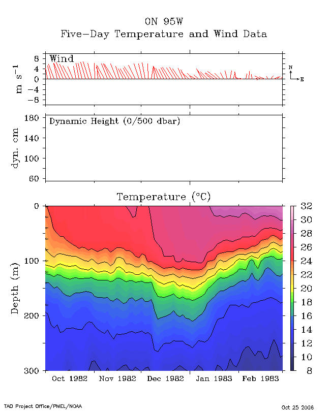
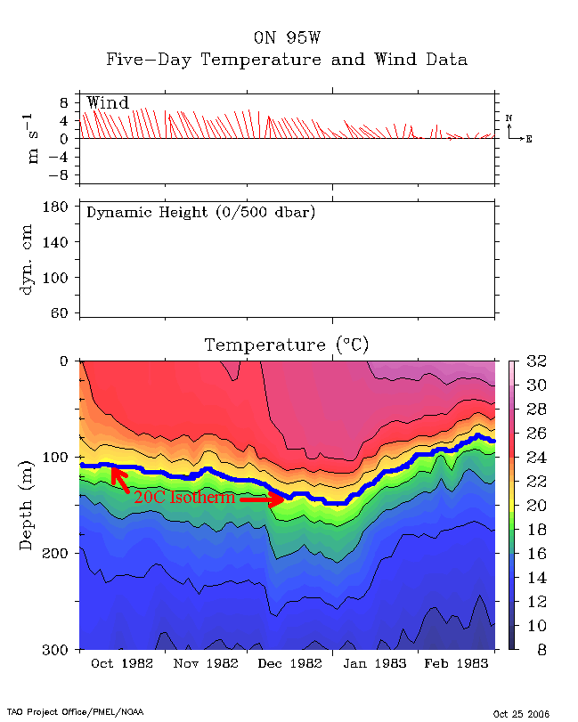
In the above images provided courtesy of the Tropical Atmospheric Ocean Web Page you can see the increase in depth of thermocline (best shown on the right hand annotated image) by the 20 degree Celsius isotherm depth line. Looking at this line you can see that for the period of October 1, 1982 through February 28, 1983 the 20C line (and the thermocline in general) increase in depth from about 105 meters in October 1982 to almost 150 meters by January 1983 and then just as quickly return to the range of 100 meters by about the end of February 1983. These images clearly show that there is a definite and dramatic change in the temperature structure of the ocean below the surface, with it becoming warmer at around the 100 meter depth near the end of December 1982 until the end of January 1983 shown bye the fact that you had to descend deeper to find the same temperature level) and then just as quickly it became cooler again near the end of the period with the 20C isotherm rising to above 100 meters by March 1, 1983. To look further at what else was occurring at the time return to the main page and lets look at another item of data that may give us a clue as to what El Nino was doing to other aspects of the ocean or atmosphere.
|