| |
| George R. Kasica
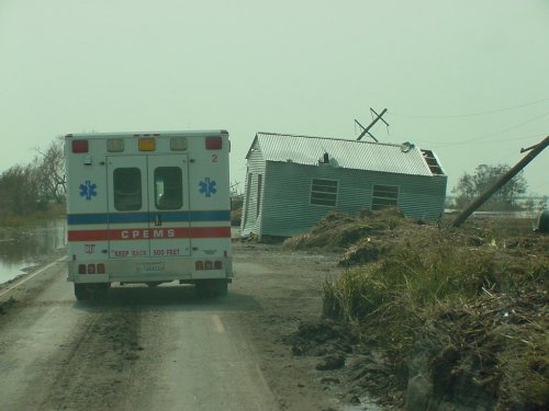
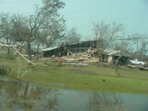
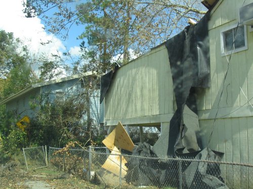
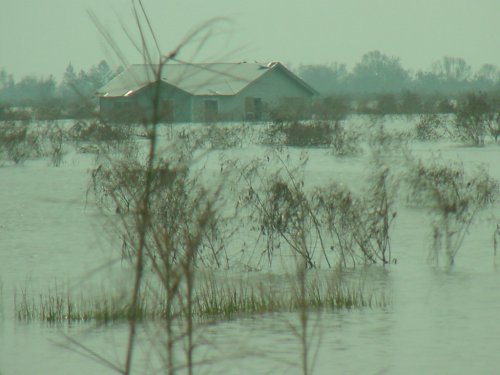
METEO 241 Portfolio #3: Hurricane structure analysis of hurricane Rita - 2005 In the following pages I'm going to discuss several topics concerning hurricane Rita during the period from September 7 - 26, 2005. My reason for picking this storm was that I happened to be in the Dallas/Ft. Worth TX area just a day before the storm made landfall as a Category 3 storm. Landfall occurred at 0740 UTC September 24 with an estimated intensity of 100 kt, in extreme southwestern Louisiana just west of Johnson’s Bayou and just east of Sabine Pass (Click here for a complete history of the storm courtesy of the National Hurricane Center tropical cyclone report archive). Though the area I was in was not directly affected by the weather of the storm, it was heavily impacted by the crush of people evacuating the coastal areas to points north. What has been an easy 20 minute commute the day earlier turned into a 90 minute crawl that could have been done faster by walking due to the thousands of people flooding into the area seeking shelter from the coming storm. In this way the storm made an impression on me not so much for it's damage in the area, as there was little to none in the Dallas/Ft. Worth area, but for the huge upheaval it created in the day to day routine of life for those there. In terms of
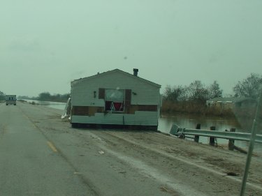
damage however, Rita was quite capable of causing significant impact to the
area as the photos below show. As you can see in the first three photos
there is great evidence of the earlier mentioned 100 kt. winds that Rita
brought on shore in the area. Also in the second photo you can see clear
evidence of the flooding that also typically accompanies a powerful category
3 hurricane such as this. In this case it was not caused by the storm surge,
as Cameron Parish is not that close to the open water, but by the torrential
rains from the storm. If there's any doubt as to the power of the storm in
the first four photos, the last image of a house being moved should attest
to the power of a storm such as Rita and why when an evacuation order is
given, as in this case, it is best to heed it and leave the area before the
storm arrives.
Now that we've looked at some of the damage that hurricane Rita left behind as it finished its lifetime in the Gulf Coast, lets take a look back in time and see how hurricane Rita formed, what steered the storm to this location, how it grew to the level of intensity it did, look at a visually striking feature of a strong storm known as the "stadium effect", and finally reflect on what was learned from this powerful category-3 hurricane. To explore these areas, click on each of the following links to read about the various topics:
| ||||||||