| |
| George R. Kasica
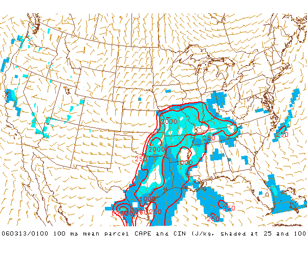
METEO 361 Portfolio #3: Supercell Tornadogenesis The environment around this area of instability was quite favorable for the formation of severe thunderstorms as well as shown by this 7pm CDT 100mb Mean-Layer CAPE graphic
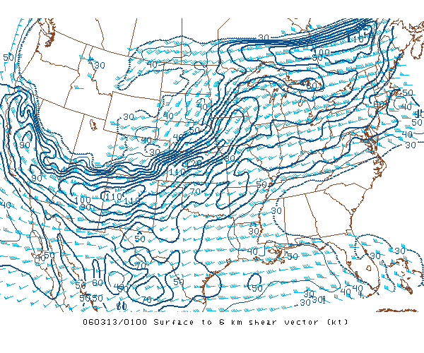
which indicates values over 2000 J/kg over much of the central US at the time, a level that is extremely conducive to the formation of strong or severe thunderstorms as it indicates that the air in that environment is very warm and moist as compared to the air around and above it and thus very capable of producing producing string updrafts due to the tendency of the air to be very buoyant (i.e. very likely to rise - "Moderately Unstable" to use the SPC classification), this property is a key ingredient for thunderstorm formation. Looking closer at the ingredients in the area that the storms formed in we can look at another key value for potential severe thunderstorm formation and that is the 0-6km Vertical Wind Shear profile.
This data item indicates the amount of change in wind direction and speed as you ascend in altitude from the surface up to 6km in altitude. These vertically changing wind directions and speeds are another important ingredient to allow the storms to begin to form the need rotating, upward moving winds that are necessary to generate and maintain the storms for a long period of time. In the profile from 7pm CST you can see the 70-100 knot values in the areas over Oklahoma, Missouri, Arkansas and Illinois are far above the typical 35-40 knots that the Storm Prediction Center feels is necessary for supercell formation, and in fact in many areas the values were more than twice that range. |