
| |
| George R. Kasica
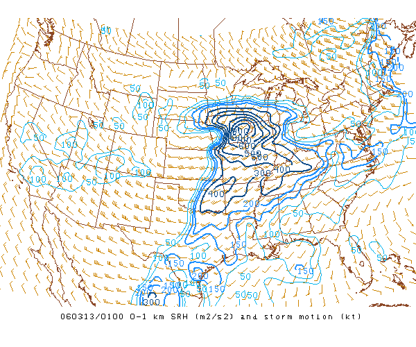
METEO 361 Portfolio #3: Supercell Tornadogenesis A second area we can look at is the value of 0-1km storm relative helicity from 7pm CST that evening.
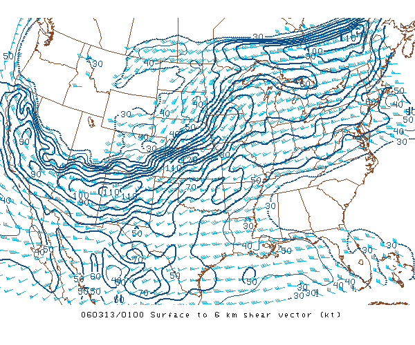
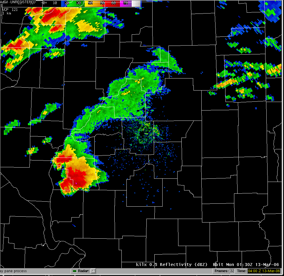
As you can see from the image, the values were at a minimum in the 400 m2/s2 range and far beyond that into the 800 m2/s2 range farther to the north. Again this was well in excess of the SPC's guidelines of 100 m2/s2 being a minimum for supercell formation. To explain this a bit more simply, the storm relative helicity is a measure of how quickly the storm is ingesting or sucking up the warm, moist air it needs as fuel to continue to form and sustain itself, the higher the value the faster the storm is taking in this critical fuel for it's existence, it also measures the amount of spin the incoming airflow has as well, and as we saw earlier with the 0-6km shear vector parameter, spinning air is vital to thunderstorm formation and longevity. Another item we can look at is the direction any potential storms may move. This can be done by using what is known as the Rasmussen Technique (click for the full technical paper explanation). The following page and image shows that at the time the storms occurred that they should have moved from the WSW to the ENE at about 38 knots or so based on this method and data obtained from the Springfield IL upper air observations also shown on that page. In looking at radar imagery from Lincoln IL site at the time the storms were in the area (Courtesy of Pennsylvania State University) we can see that they in fact were moving in a roughly ENE direction as expected by our prediction. |