George R. Kasica
Rapid City, South Dakota Climatology
The area around Rapid City, South Dakota in
March and April (the period for which we were forecasting was from March 26 -
April 6, 2007) typically experiences temperatures in the low 50's for
high temperatures and in the upper 20's for lows during that time.
Precipitation is quite low with the average day receiving about 0.04-0.05"" of liquid
precipitation. Looking at the
extremes for the high and
low temperatures in the detailed table
(provided courtesy of
the
National Weather Service Forecast Office in
Rapid City, South Dakota NowData resource.) you can see however that
temperatures have reached as high as a summer-like 84 for a high and as low as a
bone chilling -5 degrees, so clearly a very wide range of temperatures are
possible which is typical for a continental climate such as this in a
relatively dry area. One feature of the city that does complicate
temperature forecasting similar to Atlantic City is the "Chinook
winds" which can occur when winds blow from a westerly direction down the
slopes of the Black Hills just to the west of the city which reach
elevations of up to 7,000 feet in a number of locations.. When this occurs
rapid and dramatic increases in temperature are common for the area. For a
world record example of how dramatic the effects of the Chinook wind can be
on both the rise and then fall of the temperature once the wind ceases
consider the following account courtesy of the
Internet Wiki-Pedia:
"The
Black Hills of
South Dakota are home to the world's fastest
recorded rise in temperature. On January 22, 1943, at
about 7:30am MST, the temperature in
Spearfish, SD was -4 °F (-20 °C). The chinook kicked
in, and two minutes later the temperature was 45 °F (7
°C) above zero. The 49 degree (27 °C) rise in two
minutes set a world record that is still on the books.
By 9:00am, the temperature had risen to 54 °F (12 °C).
Suddenly, the chinook died down and the temperature
tumbled back to -4 °F. The 58 degree drop took only 27
minutes."
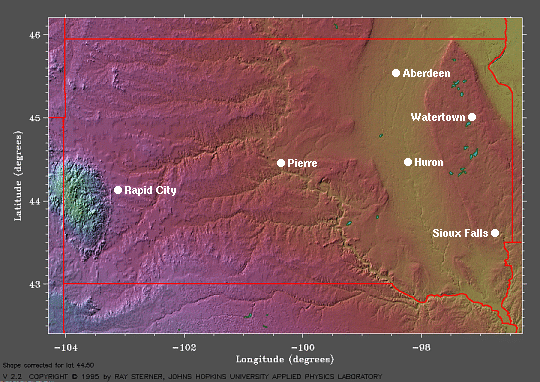
(Map of South Dakota provided courtesy of
NOAA Earth
Systems Research Laboratory)
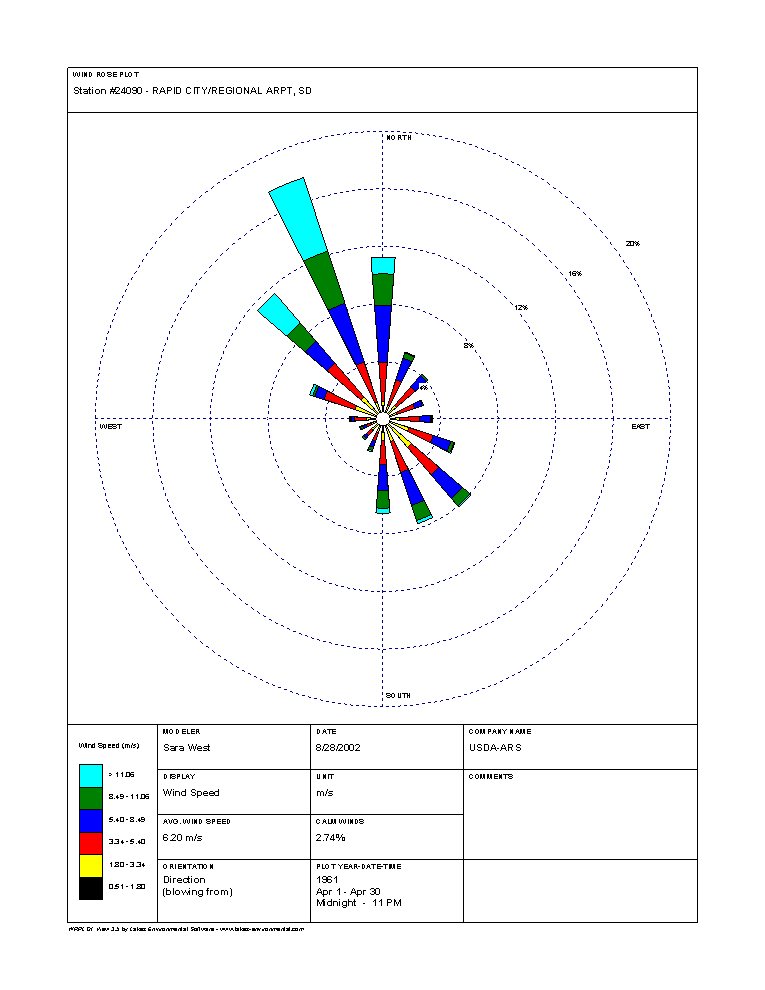
Looking more closely at wind direction, below you can see the obvious
prevalence of wind directions in the wind rose for March and April which clearly shows the prevailing
northwest winds. In March and April these winds averaged speeds
over 20 mph on many days. Further, you'll notice that the direct
westerly direction winds are rare in either month, hence chinook winds are
not a common occurrence that would lead to the dramatic temperature
fluctuation as shown above.
(March and April prevailing wind directions courtesy of
the
National Resources Conservation Service - click picture for full size
image)
In terms of precipitation, March is the
snowiest month for the area around Rapid City with it receiving about 9.1"
in a normal month. The record amount for March is 30.7" in 1950. And
although large single snowfall amounts are rare back in 1973 they received
14.9" in one 24 hour period in March. April however is somewhat lower in
terms of snowfall with the normal being 6.2", however they do still receive
large amounts of snow at times such as in 30.6" for the month in 1970, which
also had a 24 hour amount of 16.0" of snow. Total liquid precipitation for
the area in March and April is 1.03 and 1.86" respectively. As you can see,
although March is the snowiest month of the year for the area, predicting a
6" snowfall is not at all out of the question for either month. (All of the above climatic statistical data was
provided courtesy of
the
Rapid City, South Dakota National Weather Service Forecast Office climatic
narrative).
Given the data above, you can see that
making the forecasts for Rapid City, South Dakota will be a challenging
process indeed with many variables to consider, most definitely one being
the winds again, in terms of temperature and precipitation forecasts.
Main Page
Previous
1
2
3
4
5
6
7
Next |