 |
As
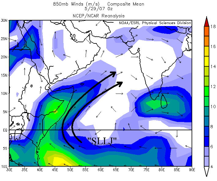
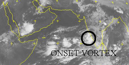
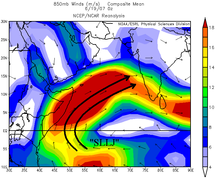
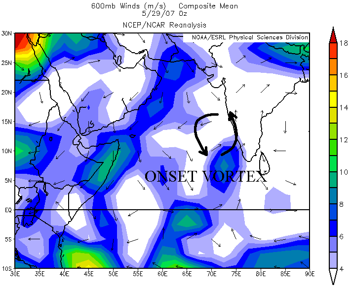
I mentioned earlier, the onset vortex began to form at the end of May,
as the cyclonic flow shows on the 600 mb wind analysis to the left.
This vortex normally increases the moisture laden flow of air into
India which enhances convection. Once in a while, an onset vortex turns
into a tropical depression or stronger, but usually it remains weak and
moves
to
the northwest away from India and eventually dissipates; however, due
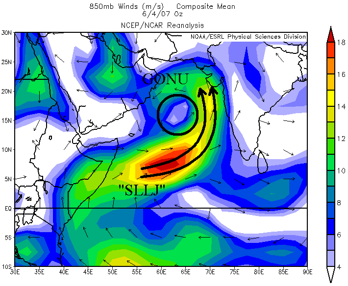
to very favorable conditions, this vortex intensified dramatically. By June
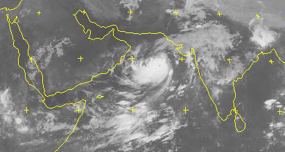
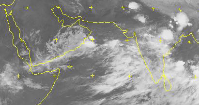
2, Tropical Cyclone Gonu formed from this onset vortex. Satellite imagery from this date shows Gonu strengthening over the Arabian Sea. As a result, thunderstorms over India were
only scattered at best. |