| |
| George R. Kasica
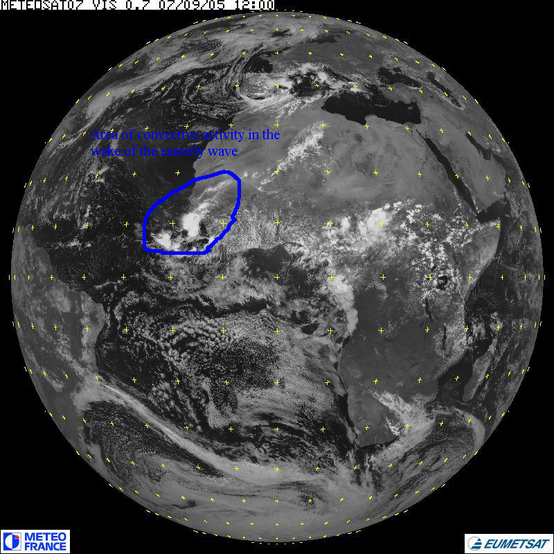
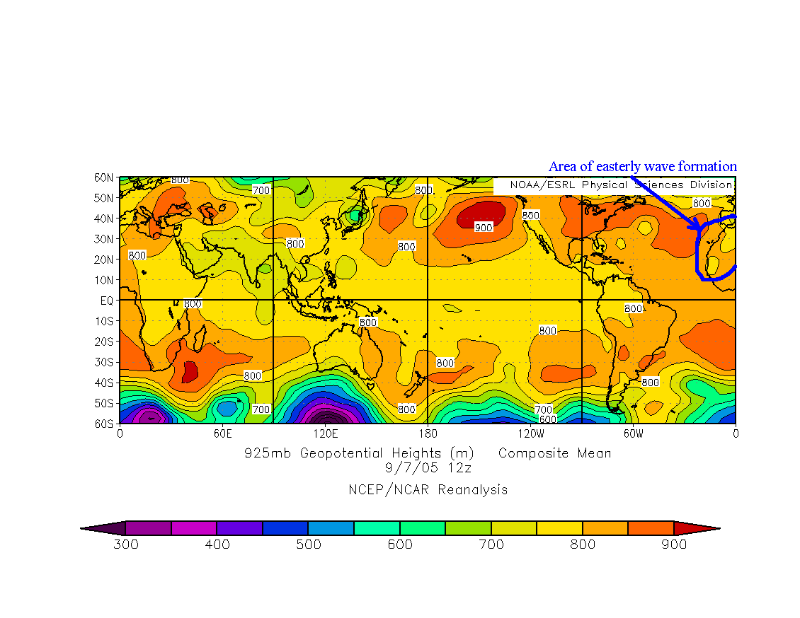
METEO 241 Portfolio #3: Discussion of the easterly wave that preceded the formation of hurricane Rita on September 7, 2005 In this section of our analysis of hurricane Rita we will look at the structure and conditions surrounding the easterly wave that preceded the formation of hurricane Rita. We'll be specifically looking at the time period of September 7, 2005. On September 7, 2005 an easterly wave moved off the western coast of Africa as shown in the satellite image and corresponding 925mb height chart below. On these you can see evidence of the convection that is typical in the wake of the easterly wave at this point in its life cycle highlighted below (click either image for a full size view) in the form of bright white clouds which indicate convective activity:
In the left visible satellite image you can see the annotated area of convection that is known to form in the wake of the passage of an easterly wave as it moves off the west coast of Africa and into the eastern Atlantic ocean. This area of convection is formed due to the area of upward motion found in the wake of the easterly wave, as shown by the indicated area of lower heights in the right image of 925mb heights which is indicative of an area of lower pressure. As we know, low pressure centers are also areas of upward motion, which is a key ingredient in causing and maintaining areas of convection similar to what we see on the the left visible image. Therefore in looking at the two images above we can see how the easterly wave, its resulting area of lower pressure and hence eventual ascending motion causes an area of convective activity to form off the west coast of Africa that would eventually become hurricane Rita several days later. For more on the track of the storm, either click here to proceed or select another area to investigate from the main page. |