
WET BULB TEMPERATURE
After precipitation begins to fall, there's still more for forecasters need to look at, one of them being the wet-bulb
temperature. From another look at the 00Z sounding from
Albany, below, you can see that the wet-bulb freezing level is 943 mb which
corresponds well with the MD stating it's between 1,500 and 2,000 ft., Buffalo's WBZ is also at this level.
Next, it says this level is likely to fall due to evaporational
cooling (even though the MD accidentally says radiational cooling).
This seems very reasonable given the dry air below 700 mb, also
shown in the image below.
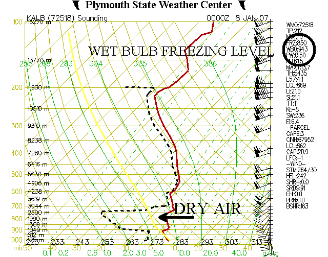
This is the 00Z sounding from Albany on January 8, 2007 which shows the wet-bulb freezing level, courtesy of
Plymouth State Weather Center.
Last, the MD states the precipitation should start in the form of
snow due to the wet-bulb cooling effects from the dry air, but the
strength of the warm advection may
soon change it to freezing rain, as I said before. This is very
possible, as the image below shows there's pockets of freezing
temperatures at the surface in extreme northern New York and Vermont at 06Z. Plymouth State's meteogram from Burlington shows precipitation reaching the ground by then.
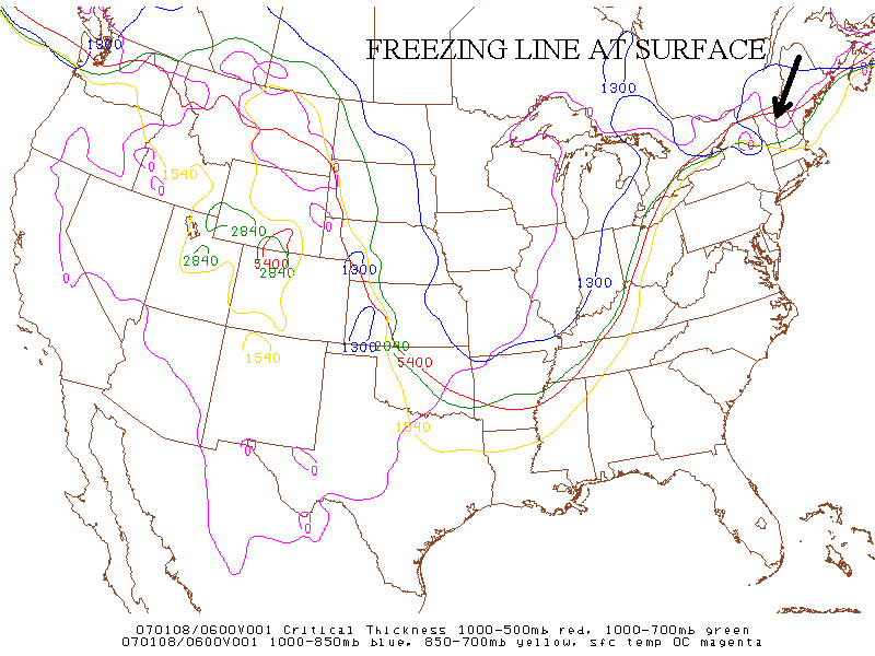
This map of critical thickness levels from 0600Z on January 8,
2007 shows the freezing line at the surface which supports pockets of
freezing rain in
northern New York and northern Vermont, courtesy of SPC's Daily Archive Directory.
This winter storm is very typical for the Northeast in January,
snow, freezing rain and rain all within a short distance. This
mix of precipitation make predictions even more challenging for
forecasters and dangerous for the public. That's why people need
all the weather information they can get and mesoscale discussions help
accomplish that.
PAGE 1 2 3 4 5