| |
| George R. Kasica
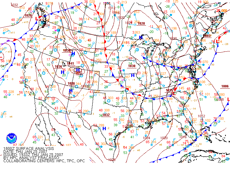
San Antonio Forecast Day #4 - 0600Z January 26 to 0600Z January 27, 2007 The fourth, and last, day of the forecasting period was Friday, January 25th and the time period it covered was again from 0600Z on the 26th to 0600Z on the 27th, this again was due to the fact that San Antonio, Texas is 6 hours behind the time in Greenwich, thus the offset of 6 hours rather than a midnight to midnight time frame. The big picture for the area was very similar to the day before in that there was little chance for precipitation, skies would likely be clearing and temperatures would be returning to more seasonable levels, as shown below by the 18Z surface chart for January 25, 2007 that shows the entire area around San Antonio to be under the influence of a high pressure system.
Looking at the 12Z and 18Z MOS outputs (click for full view) the models they were again extremely close in terms of their predictions for high and low temperatures and wind speeds. As a result of this I again went with a forecast that was a consensus of the various model numbers as there was little reason to deviate from them. My forecast for the day was a slight warmer high of 62 than the day earlier of 60 due to the increased solar heating, a low of 38 the same as the previous day, and also similar wind speed of 10 kts (15 mph) since the other conditions were also similar.
Looking towards the precipitation forecast the 12Z and 18Z FOUS outputs again did not indicate any measurable precipitation on any of the three outputs during the time period of the forecast, though on the 12Z NAM output indicated 0.17" at for the 6 hour period from 6Z until 12Z, just after the the end of the forecast period. Also, the 18Z ETA FOUS indicated 0.16" as well for the same period of time (bold green highlights on detail). As a result of this I chose to go with 0.05" of precipitation to account for the possibility that the precipitation may arrive quicker than forecast, I didn't want another unpleasant surprise like earlier in the week. The actual results for the day (click for METARS and climate summary) were very close to what I had forecast with a high of 63, a low of 34 and a maximum wind speed of 17 mph with out any precipitation being recorded. The detailed METARS showing the high and low temperatures in degrees Celsius are shown below. Again, in the first line from 2353Z, the high temperature is shown in the group of numbers starting with 1 in red, bold underline which indicated that the high temperature occurred sometime in the previous 6 hours. The next 0 indicates that the following temperature is above zero and the last three digits of 172 indicates a temperature of 17.2C or 63F. The second line indicated the days low temperature within the 6 hours before 1753Z. You can see that the value in the blue group in bold stating with a 2. The following zero, like in the 1 group above it, indicates a reading above 0 and the 11 stands for 1.1C or 34F:
KSAT 262353Z 14012KT 10SM OVC040 14/06 A3006 RMK AO2
SLP171 T01440056 10172
20144 56010 This last day of forecasting the results were again quite good as compared to the first two days of the week, again, mainly due to the fact that I was not trying to outguess the models, but instead using the information given as a guide and taking the consensus of the various outputs. Again, though, this forecast situation was similar to the previous days and far less complex in terms of timing for arrival of precipitation and the possible amounts that could be received. |