
GREEN BAY'S CLIMATOLOGY
Green Bay, Wisconsin is located at the mouth of the Fox River
which empties into the south end of Green Bay. The terrain in
this part of the state is relatively flat, as you can see from the
topographical map below. Being close to the Bay, Green Bay's
elevation is only approximately 680 feet. Its close proximity to
Green Bay and Lake Michigan work together to help modify the climate.
This modified continental climate limits the occurrences of days
over 90 degrees and below 0 degrees, often due to cloudiness caused by
the lakes.
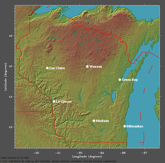
This is a topographical map of Wisconsin which shows Green Bay's proximity to the Great Lakes,
courtesy of Earth System Research Laboratory (ESRL).
The wind rose below for Green Bay in October shows that the wind
this time of year predominately blows from the west and southwest. The
windrose for November from NRCS shows
a similar story. The southwest winds are common from the clockwise
flow around high pressure systems that are situated to the south. This image of average sea level pressure from 1968 to 1996, courtesy of ESRL,
shows the position of many of these highs. Autumnal cold fronts,
also, have southwest winds ahead of them. Once they move through,
the west and
northwest winds start to blow, bringing in much colder air from Canada.
The average wind speed at the time of the WxChallenge is
approximately 9 knots, but on most days, the maximum two-minute wind speed would definitely be higher. Finally, the Local Climate Data
for Green Bay shows that the record two-minute sustained wind speed for
October is 36 mph (32 knots) and for November is 45 mph (39 knots). So, predicting a wind speed higher
than this would be a very bad idea.
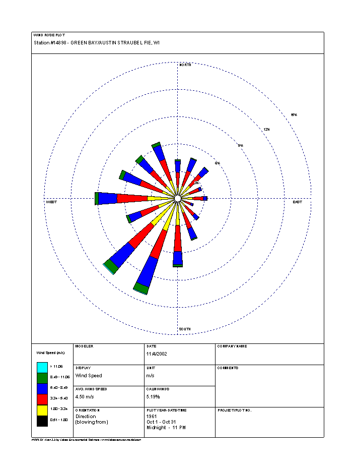
This is a wind rose plot, showing Green Bay's wind in October blows most often from the west and southwest, courtesy of National
Resources Conservation Service (NRCS).
Knowing the average temperatures and precipitation, as well as the
extremes, will be very helpful in the WxChallenge. Let's look at the Daily Almanacs for the contest period: October 28, October 29, October 30, October 31, November 4, November 5, November 6 and November 7.
From these Daily Almanacs, you can see the average high temperatures
range from 52 degrees on October 28 to 47 degrees on November 7.
These temperatures are a good starting point in predicting what
the actuals will be. On the other hand, the record high
temperatures for this period range from 66 degrees to 77 degrees, most
likely as a result of southerly winds from strong mid-latitude low
pressure systems moving west of Green Bay. Also, it's important
to know the lowest maximum
temperatures on record, which at this time of year varies from 20
degrees to 32 degrees, as arctic outbreaks begin to arrive from Canada.
The Daily Almanacs show the average low temperatures range from 33
degrees on October 28 to 29 degrees on November 7; however, the record
lows get much colder. They vary from 18 degrees all the way down
to -5 degrees on November 6, 1951, a real arctic outbreak. Milder weather is still not out of
the question, though.
The highest minimum
temperatures in Green Bay range from 48 to 62 degrees, again as low pressure moves west of town.
Because the majority of Green Bay's precipitation falls during the
growing season, the average daily precipitation this time of year is
only .07 inches or .08 inches, due to the presence of lower levels of moisture and dew points; however, this record of
daily maximum rainfall shows high levels of moisture can still reach
the area on occasion. You can see it varies from .54 inches on November
6 all the way to 2.23 inches on November 1.
Next, I'll provide you with the big picture for Green Bay on October 31, a day my high temperature forecast busted.
1 2 3 4 5 6 7