
LESSONS LEARNED
As I mentioned, I learned some important things as a result of
this forecast. One very important thing I learned about MOS is that wind direction is a MOS
temperature predictor. After looking at
the forecast surface map below valid at 12Z October 31 showing a cold front near Green Bay and seeing the change in
wind direction on these MOS tables, I predicted a high temperature lower than the actual. I did this because I
automatically thought this front would be strong enough to keep the
temperature from rising too dramatically above MOS. What I didn't know was this
change in wind direction from southwest to north most likely
kept the MOS predicted high temperature a few degrees lower than it
should've.
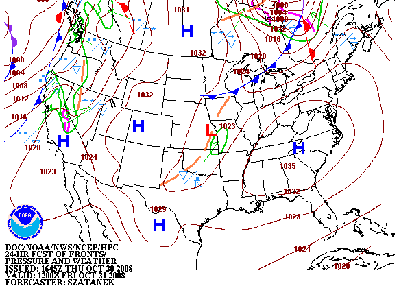
This is a forecast surface map valid at 12Z October 31, 2008 that shows a cold front passing through Green Bay,
courtesy of the Hydrometeorological Prediction Center.
One more thing I learned is to not just look at the high on
MOS when trying to forecast the high temperature. One reason is
MOS typically forecasts daytime highs too cool at locations in the warm sector where it's totally
sunny, as it was in Green Bay. You can see the front arrived at approximately 16Z from seeing the change in wind direction on this
series of METARS. Another look at
these MOS
tables shows that the winds were predicted to be weak behind the front;
therefore, the cold air advection was weak,
as well, after the front moved through. The image below of surface temperature advection valid
at 17Z October 31 indicates this was, indeed, the case. In fact, this image of surface plots, from CoolWx, across the state of Wisconsin valid at 17Z October 31shows no wind at all at Green Bay.
Not only did the MOS tables show the winds would be weak, it indicated the skies would be
clear, too. In late October, solar heating is still more than
enough to
offset the effects of weak cold air advection. As a result,
the temperature stayed in the 60's all afternoon, as this
series of METARS shows. With the clear skies and light winds, the cold front ended up having little impact on
Green Bay's weather during the day, much to my dismay.
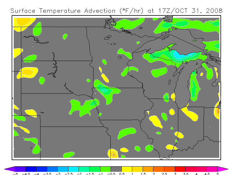
This is an image of surface temperature advection valid at 17Z
October 31, 2008 that shows only weak cold air advection to the north
of Green Bay,
courtesy of CoolWx.
A better look at the big picture would've told me just how weak the
front probably would be, then, I would've known better how to tweak MOS. At least, I learned that wind direction is a MOS
temperature predictor and how to adjust the MOS temperatures on days similar to this; therefore, I made more mistakes, as the third
city in the WxChallenge continued. Now, let's move onto a busted forecast I made in Quillayute,
Washington, but first, I'll start with its climatology.
1 2 3 4 5 6 7