
THE BIG PICTURE
Let's start by examining the surface map below from the
afternoon of April 4. A strong cold front was moving through the
Ohio and lower Mississippi river valleys, with a surface low in
southeast Arkansas, just behind a squall line moving through the area. This squall line produced an outflow boundary
which served as a focus for new convection, as the surface map shows in Mississippi and Louisiana. This dew point map from CoolWx shows better than the surface map a gradient of about 10 degrees across the area. In addition, the temperatures along with the dew points made for an area with high theta-e.
All these conditions helped make this region ripe for the
convection to continue across Alabama, by providing the heat and
humidity necessary for thunderstorms.
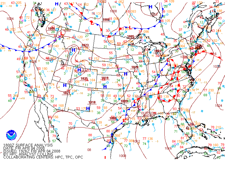
This is a surface map at 1800Z on April 4, 2008 that
shows a cold front and an outflow boundary moving into the area covered
by a tornado
watch, courtesy of the HPC.
The upper-air features played an important role, as well. The
image below of 500-mb heights shows a shortwave trough over the
southern Plains which helped produce the area of low pressure I
mentioned earlier. Also, here's a map from 300-mb from
SPC's archives,
showing a jet streak moving through the southern Great Lakes.
While it was a little far away, it was still strong enough to
produce some divergence in its right entrance region over the lower
Mississippi valley, where the tornado watch was located. This
divergence, along with the 500-mb shortwave trough, are more
ingredients that made this outbreak possible.
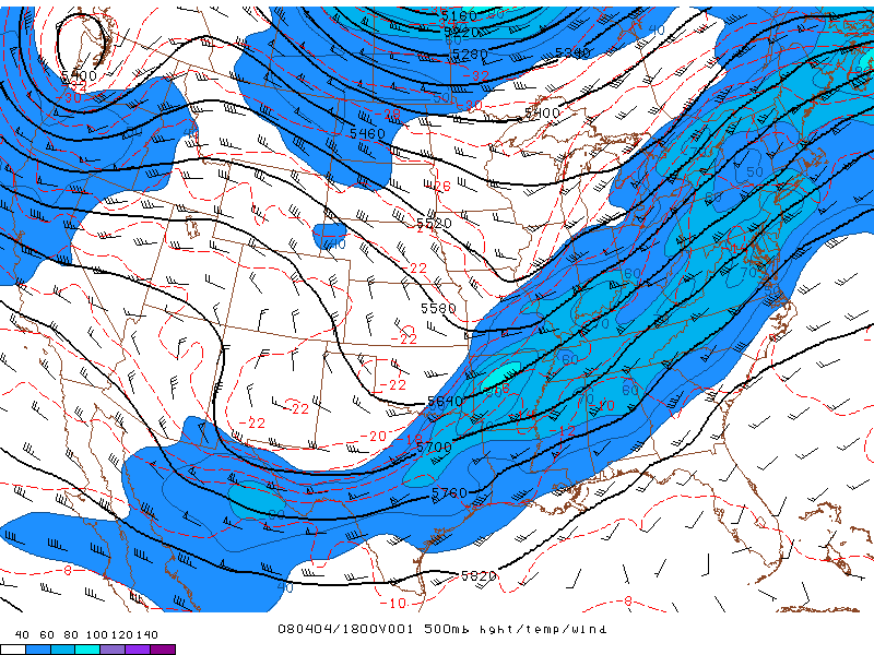
This is an image of 500-mb heights, temperature and wind
from 1800Z on April 4, 2008 which shows a shortwave trough moving into
the area with a
tornado watch, courtesy of SPC's archives.
With all of the upper-air features in place, it's time to look at the
moisture source a little closer to the surface. The lower-left
panel on the image below shows southerly winds at 850-mb. These winds transported high levels of moisture into the storm
which is needed for the formation of thunderstorms and ultimately
tornadoes. With all these features working together, the result was a large storm system, as this satellite image shows from UCAR's archive
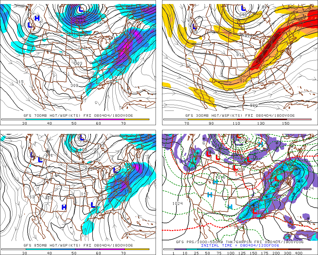
This forecast image of heights and winds at various
levels from 1800Z on April 4, 2008 shows southerly winds moving into
the area covered by the tornado watch which provided moisture for the
thunderstorms, courtesy of PSU's E-WALL.
PAGE 1 2 3 4 5