
THE BIG PICTURE
Casper, Wyoming, the next city in the WxChallenge, presented a new set
of challenges for me, as the wind greatly influenced the temperature
here. Depending on the exact position of high and low pressure
systems, the wind can blow strong all night or go completely calm.
Because I never forecasted for a place close to the Rocky
Mountains, like Casper, I was unfamiliar with the local climate
conditions that influence their weather and my temperature forecasts
really suffered this first week.
The morning of October 17 was fairly typical for me, as my low
temperature forecast was off by five degrees. I predicted 37
degrees and the low was 32 degrees. The surface map on this day,
below, shows high pressure centered just to the west of Casper, with a
weak stationary front to the north over Montana. Normally, winds
go relatively calm at night when high pressure is near; however, due to
Casper's close
proximity to the Rockies, this often isn't the case which I'll explain shortly. These MOS tables from NOAA's Meteorological Development Lab
agree in keeping the wind speed up on the early morning of October
17 which I thought might keep the temperature a little above these MOS
values.
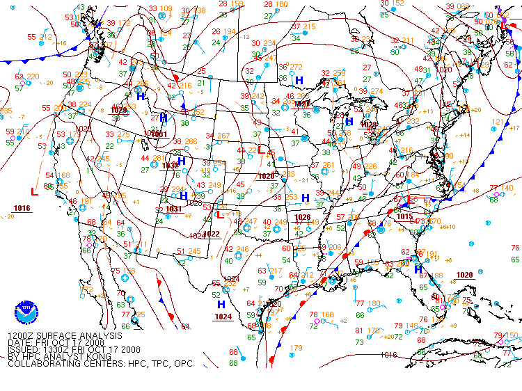
This is a surface map from 12Z on October 17 that shows high pressure centered just west of Casper, Wyoming, courtesy of
the
Hydrometeorlogial Prediction Center.
Moving on to the upper-air pattern, you can see on the map of 500-mb
heights and vorticity valid at 12Z October 17, below, that a ridge of high
pressure is west of Casper, with a series of weak disturbances over the
central plains. Even with no strong storm system in the area, I still thought by looking at this forecast surface map from NCAR there would
be enough of a pressure gradient between the high and the low over
Canada to keep the winds blowing on this night, but as was usual during
this forecasting week, I was wrong. Next, I'll tell you why and
the valuable lessons I learned to improve my forecasts.
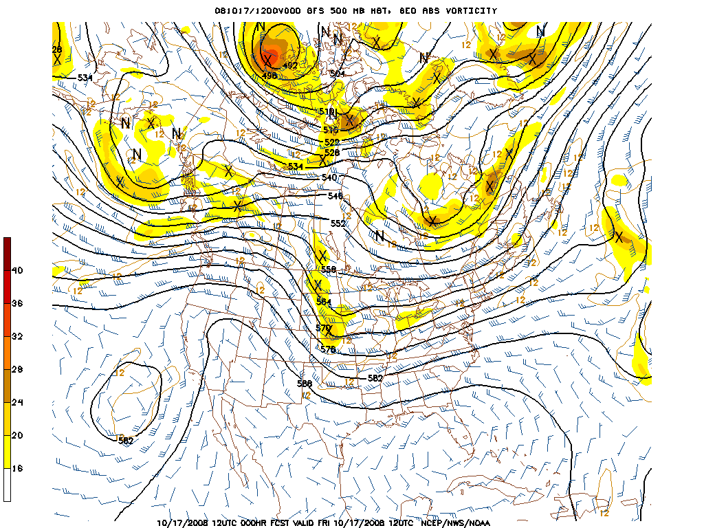
This is an image of 500-mb heights, vorticity and wind
valid at 12Z October 17 that shows a ridge of high pressure to the west
of Casper and a weak trough to the
east, courtesy of National Center for Environmental Prediction.
1 2 3 4 5 6 7