As I mentioned, my temperature forecasts were quite poor during this week. A very important lesson I learned is knowing how to modify a forecast to account for local effects at a specific site which is extremely important at Casper. As the week went on, I learned that, when there's a high near or to the west of Casper and negative pressure tendencies to the northeast, the isallobaric component causes the surface winds to blow from the southwest consistently, due to the gap in the Rocky Mountain chain over southwest Wyoming.
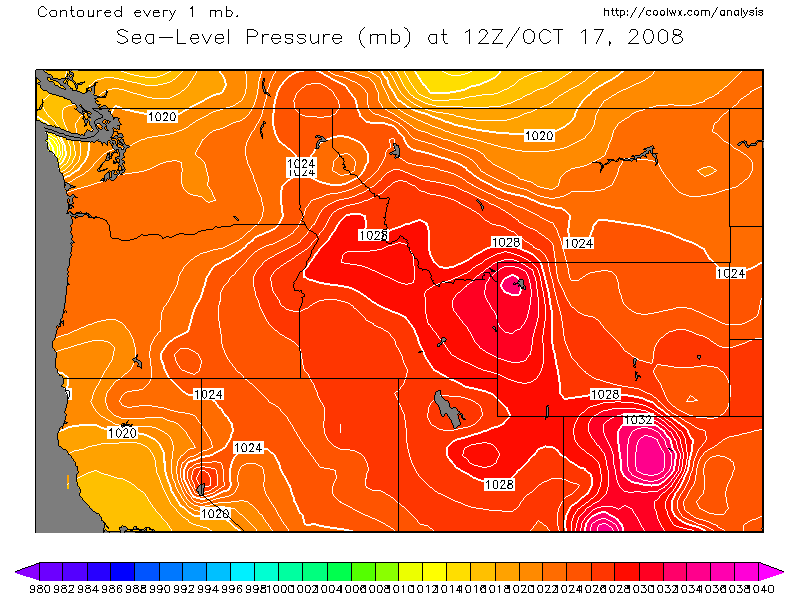
With this in mind, I thought I saw the set up for this to occur and keep the wind blowing on the morning of October 17, by looking at this forecast from the previous day. However, this is a more classic example from earlier in the week which I missed forecasting, too. As you can see, there's a stronger low moving along the U.S./Canadian border. The image below is a map of sea-level pressure from 12Z on October 17 which shows the pressure gradient is not all that strong over eastern Wyoming and eastern Montana. This allowed the winds to go calm or remain relatively light throughout the night, as this series of METARS show. As a result of the clear skies and light winds, there was greater net radiational cooling, allowing the temperature to drop to 32 degrees which was below MOS guidance.