
INTRODUCTION
| The winter of 2007-2008 was already one of the most active and deadly in history with regard to severe thunderstorm activity. February alone had a record setting 138 tornadoes, a preliminary count of course, and the start of March looked to be no different. On March 3, forecasters started to see the ingredients coming together, which I will discuss later, for what they thought would be another deadly outbreak of storms; therefore, they issued this outlook warning the public in Louisiana and Mississippi that there was a moderate risk of severe weather. The map of storm reports to the right from the Storm Prediction Center (SPC) shows there were 68 reports of either tornadoes, large hail or high winds. Luckily, the tornadoes were only isolated, but the potential was certainly there for things to be much worse. | 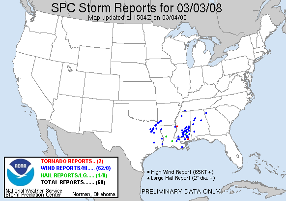 |
Today, forecasters are much better equipped to see outbreaks of severe weather hours before it happens. Doppler radar has even increased warning times for people to take shelter from six to twelve minutes. In addition to Doppler radar, forecasters look at many other surface and upper-air observations to help them better predict these violent thunderstorms. In this report, I'm going to further examine some of the signs that made this outbreak so apparent. Let's start with the synoptic set up.
PAGE 1 2 3 4 5