
As you know, March 2008 came in like a lion, just like February left off. Let's start off by examining the surface map below from the late afternoon of March 3. The primary surface low was in southeast Arkansas with a strong cold front extending south through Louisiana and another cold front extending northeast to a low pressure near Lake Huron. Although you can see the strong temperature gradient on the surface map, this temperature analysis from CoolWx clearly shows a 30 degree difference over just several hundred miles from northeast Texas to Louisiana. Not only was the temperature gradient dramatic, the dew point gradient was, too, but these factors were only part of the reason for this severe weather outbreak.
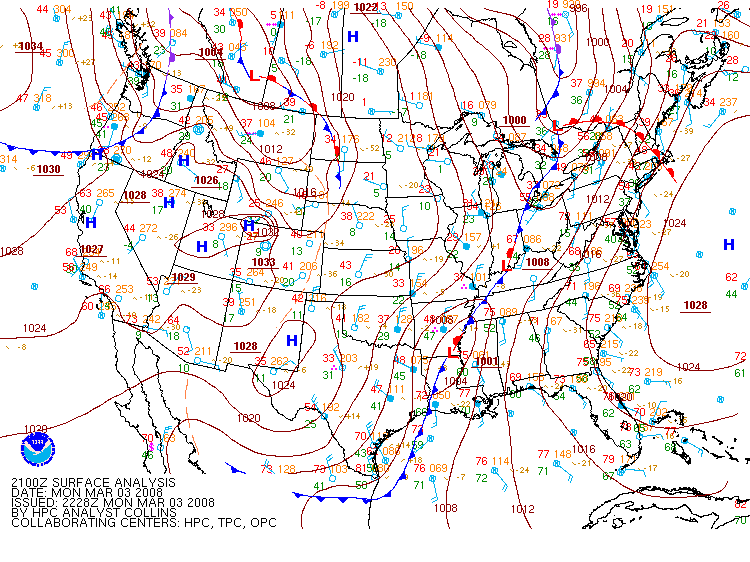
This is a surface analysis from 2100Z on March 3, 2008. It shows a strong low pressure over southeast Arkansas which helped spawn
severe thunderstorms, courtesy of the HPC.
The upper-air features, also, played a pivotal role. This image of 500-mb heights from SPC's Archives shows a strong cut-off low over Texas and Oklahoma which provided the upper-level support needed for the surface low to develop. These surface lows always develop to the east of the 500-mb troughs which the map above shows. Also, the map at 300-mb below shows the low cut-off at this level over Texas, as well as, a powerful jet streak moving through the Great Lakes. This jet streak produced considerable mass divergence in its right entrance region over the lower Mississippi valley which the map shows, too. This divergence is yet another critical factor in the formation of a severe storm outbreak.
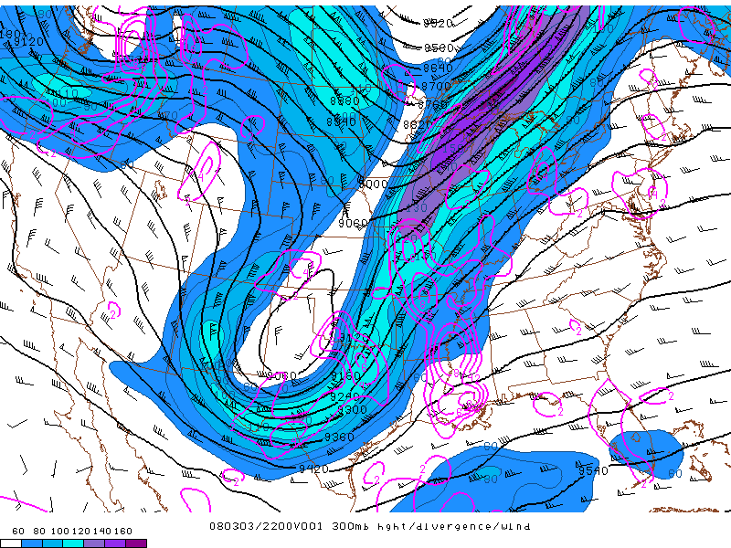
This is an image of 300-mb heights, divergence and wind at 2200Z on March 3, 2008 which shows a strong jet streak over the Great Lakes and its
corresponding divergence over the Mississippi valley, courtesy of SPC's Archives.
Now that all of the upper-air features were in place, let's look at the moisture source a little closer to the surface. The lower left panel on the image below from 00Z on March 4 shows strong southerly winds at 850-mb, transporting moisture from the Gulf of Mexico into the storm system. This low-level jet provided the high levels of moisture needed for the thunderstorms to form. With all these features working together, the result was a classic looking cyclone which this satellite/radar image from Ohio State's Archive shows.
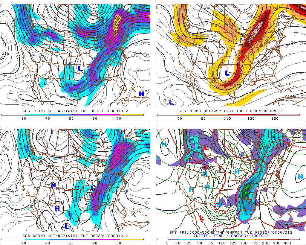
This forecast image of heights at various levels for 00Z on March 4, 2008 shows a strong transport of moisture into the storm at 850-mb which gave fuel for the thunderstorms, courtesy of PSU's E-WALL.
PAGE 1 2 3 4 5